Welcome back if you’ve stuck with us this long, and if not, go back and read the rest first, this isn’t a choose your own adventure!
After collecting the community’s input, studying precedents and defining “uses” our last step was to design (our favorite part!). We developed several schemes for the Licking River site that directly respond to key needs in West Newport. Each scheme carefully considers the scale of proposed development in relation to existing buildings and context. The designs prioritize increasing residential density, expanding parks and green spaces, and creating connections to the riverfront and levee wall. In addition, we propose incorporating light industrial, commercial, and community-use buildings to enhance neighborhood vibrancy, generate local employment, and provide services that support long-term community growth and resilience.
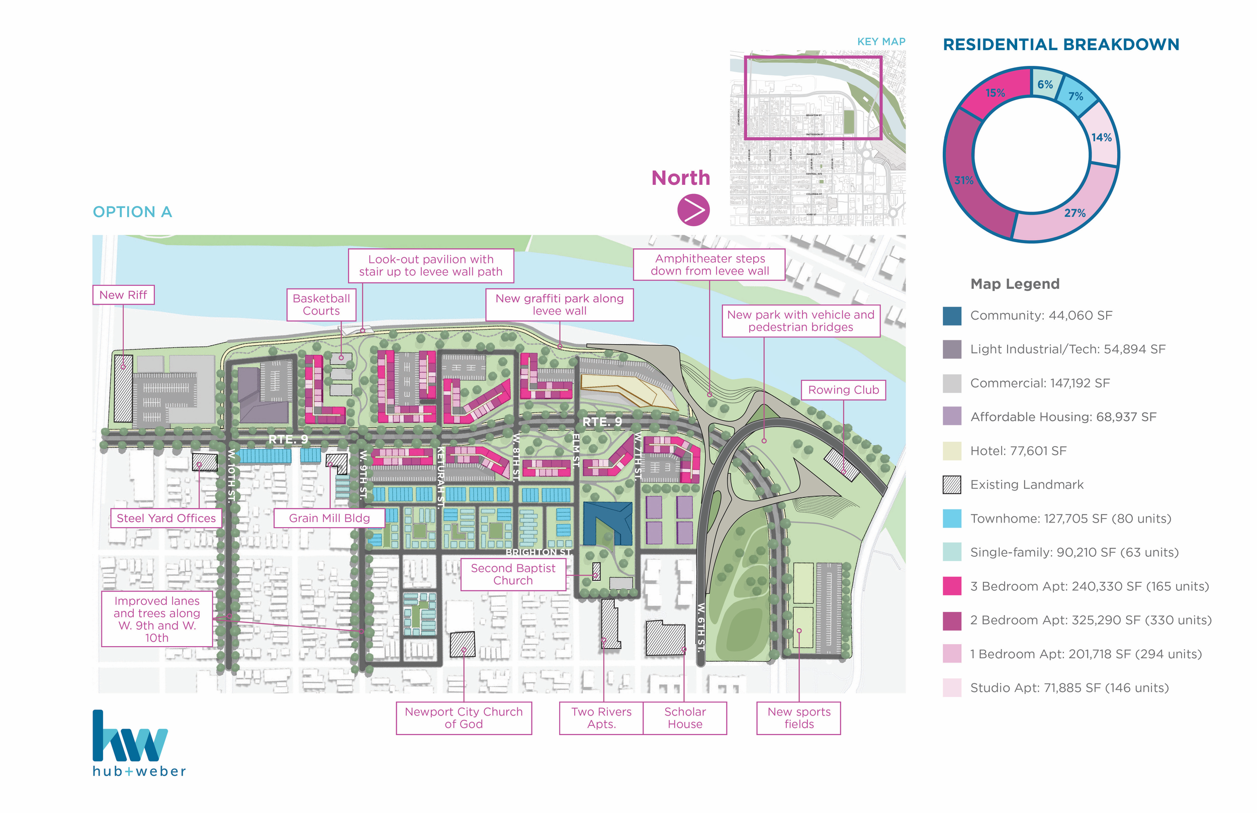
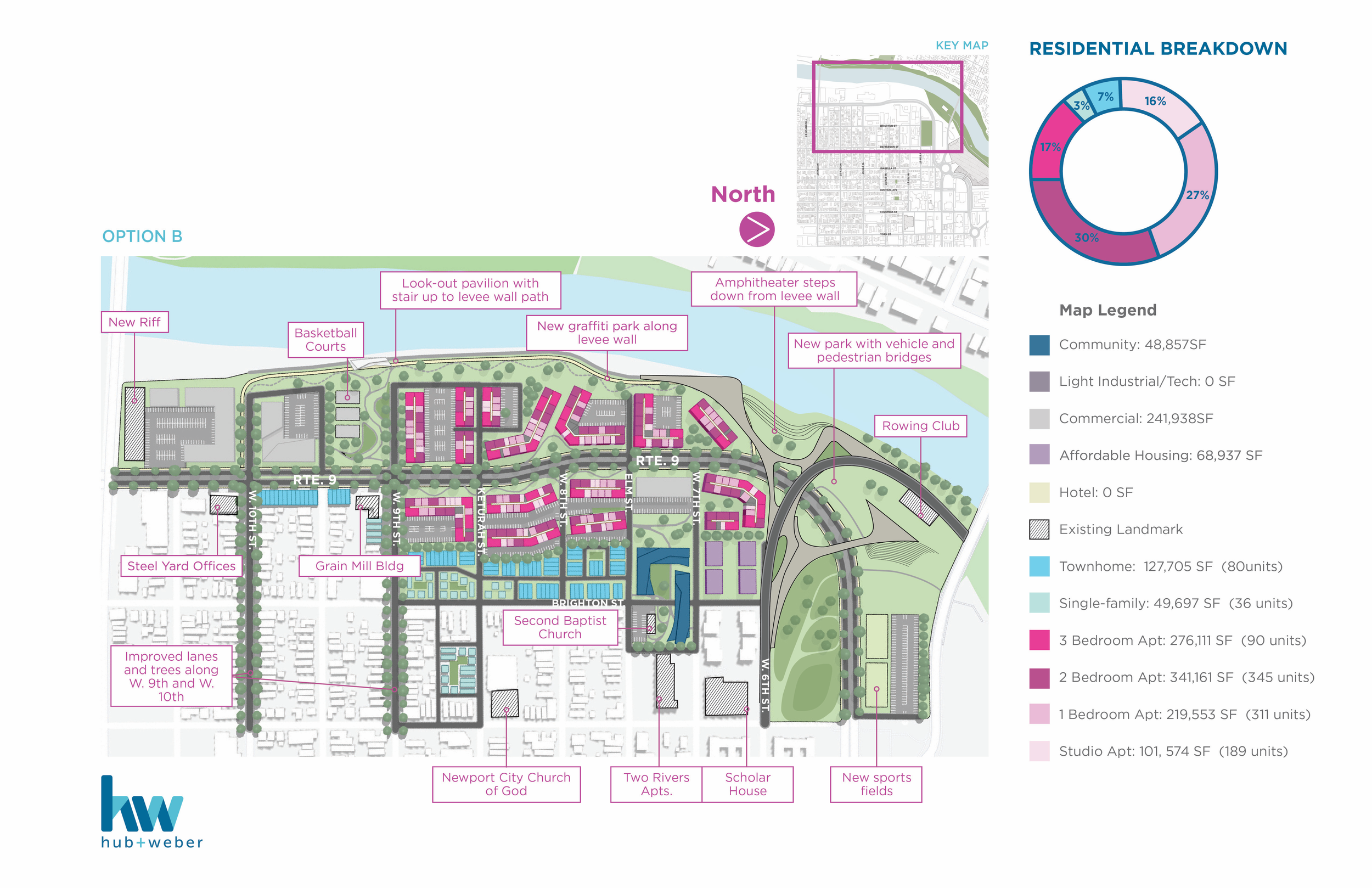
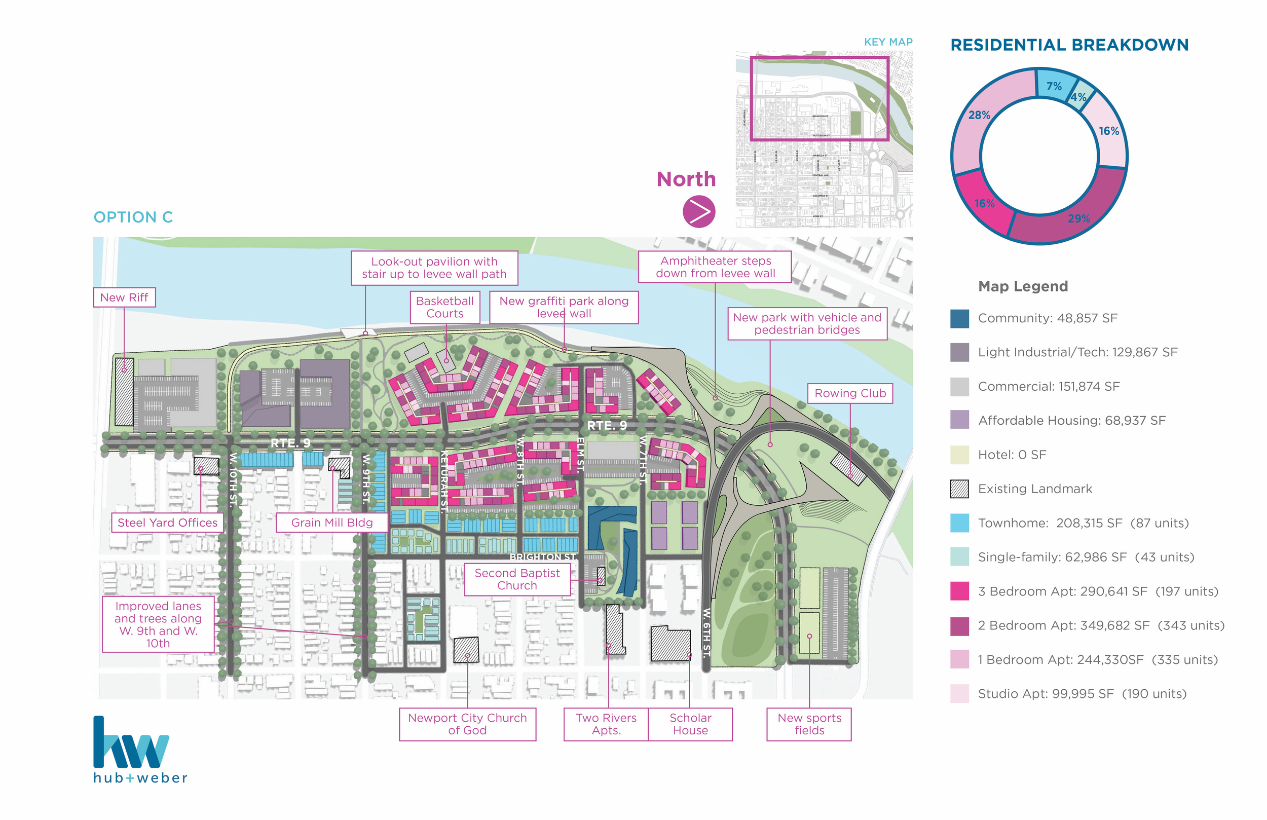
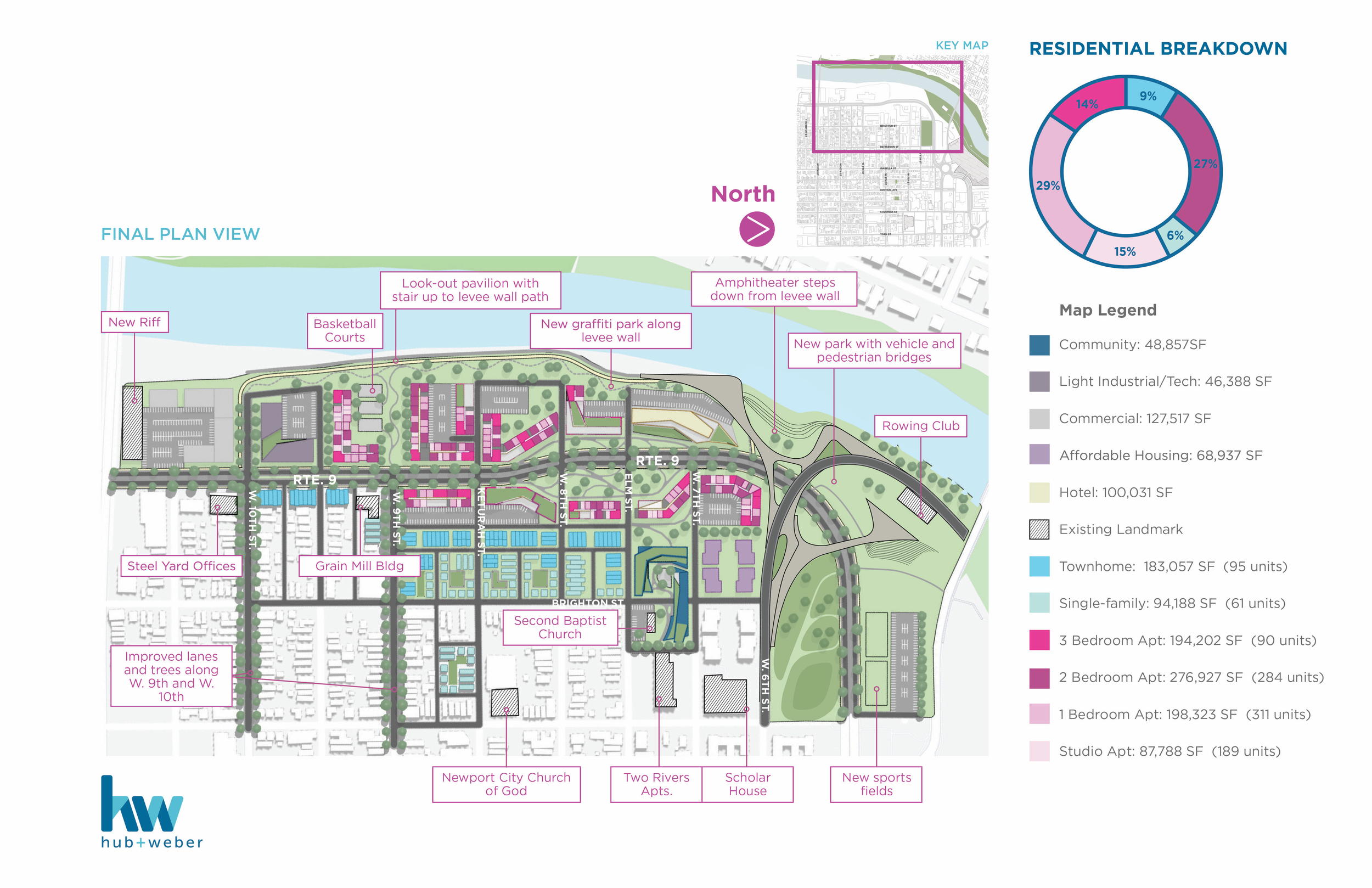
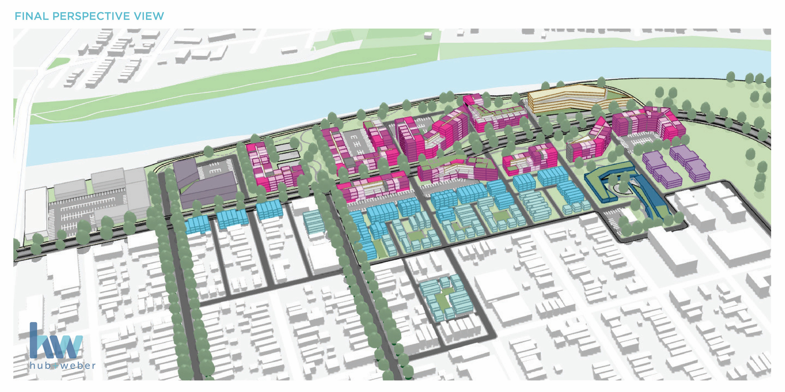
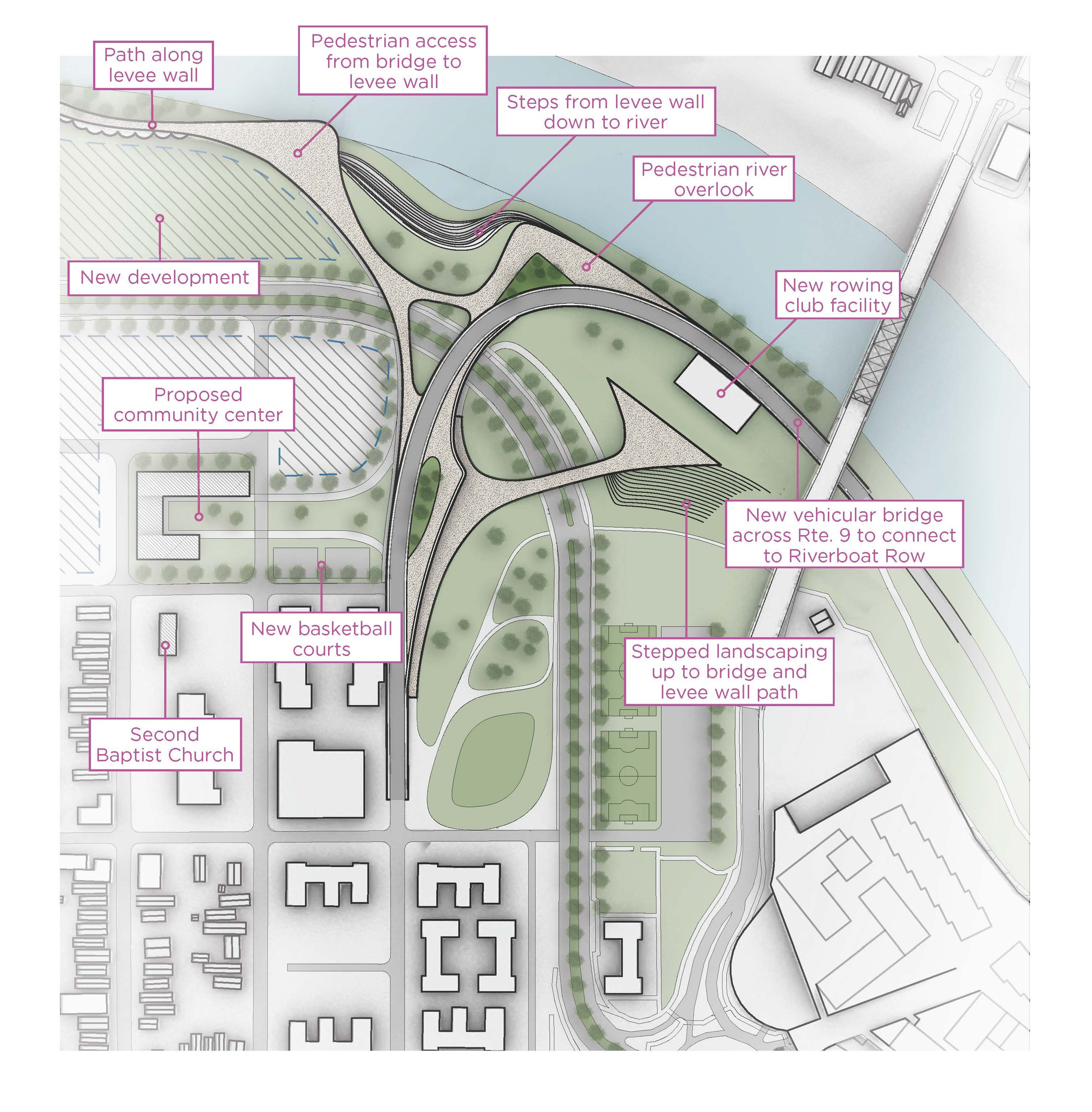
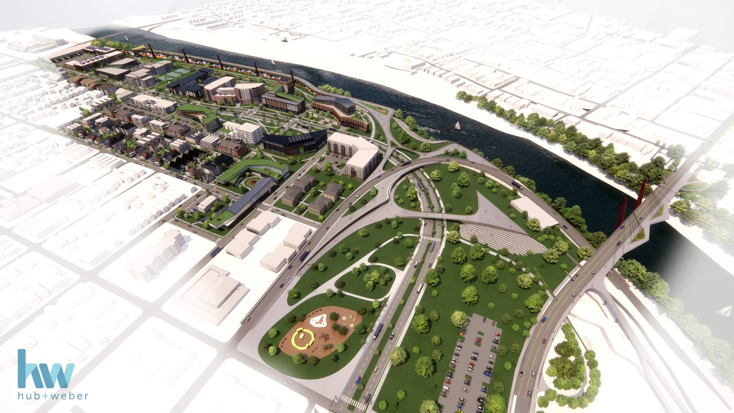
The residents emphasized the need for parks and green space. While our proposal does include several small-scale green spaces scattered throughout West Newport, the far northwest corner, by the Fourth Street bridge, offers a unique opportunity for a larger scale park. This exploration includes several amenities and changes to the landscaping and infrastructure in the area.
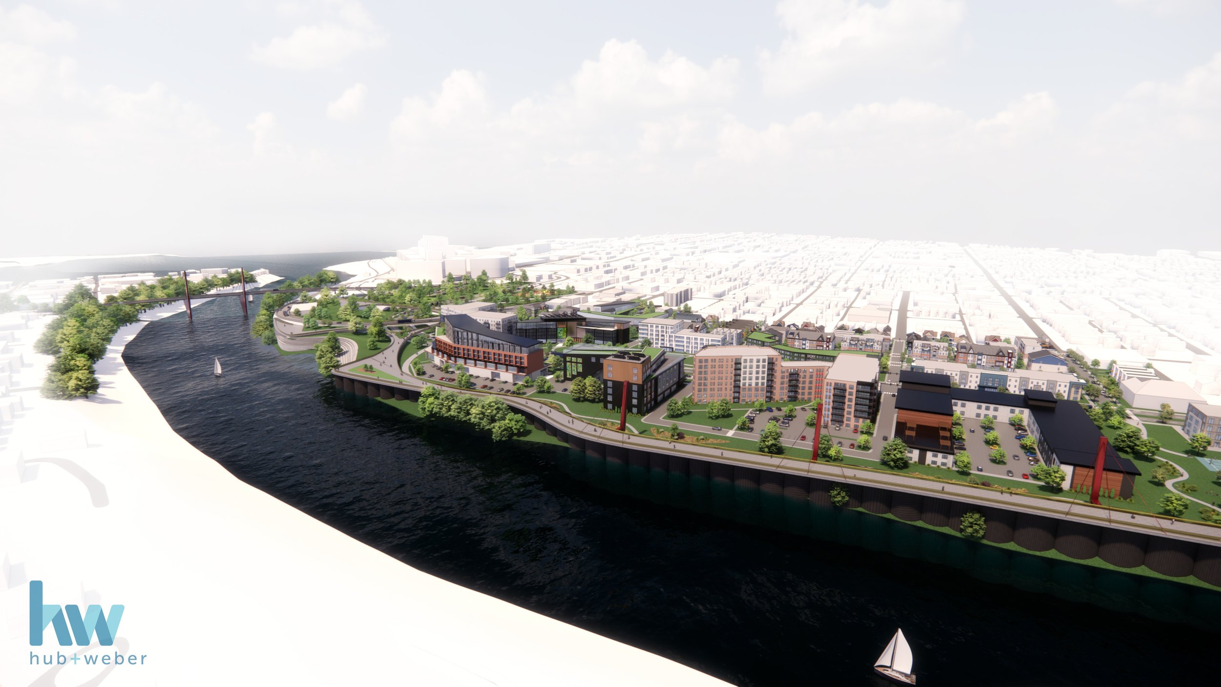
A new vehicular bridge extending over Route 9 and down to River Boat Row would provide access to a brand-new rowing club facility. Currently this edge of town doesn’t have safe pedestrian access to the riverfront from the west side, but this large pedestrian bridge would provide safe passage for pedestrians across Route 9 and would connect the various regions of this new park to one another. This bridge would also serve as an access point to the top of the levee wall, which could be engaged as a walking/biking path with a series of pedestrian overlooks.
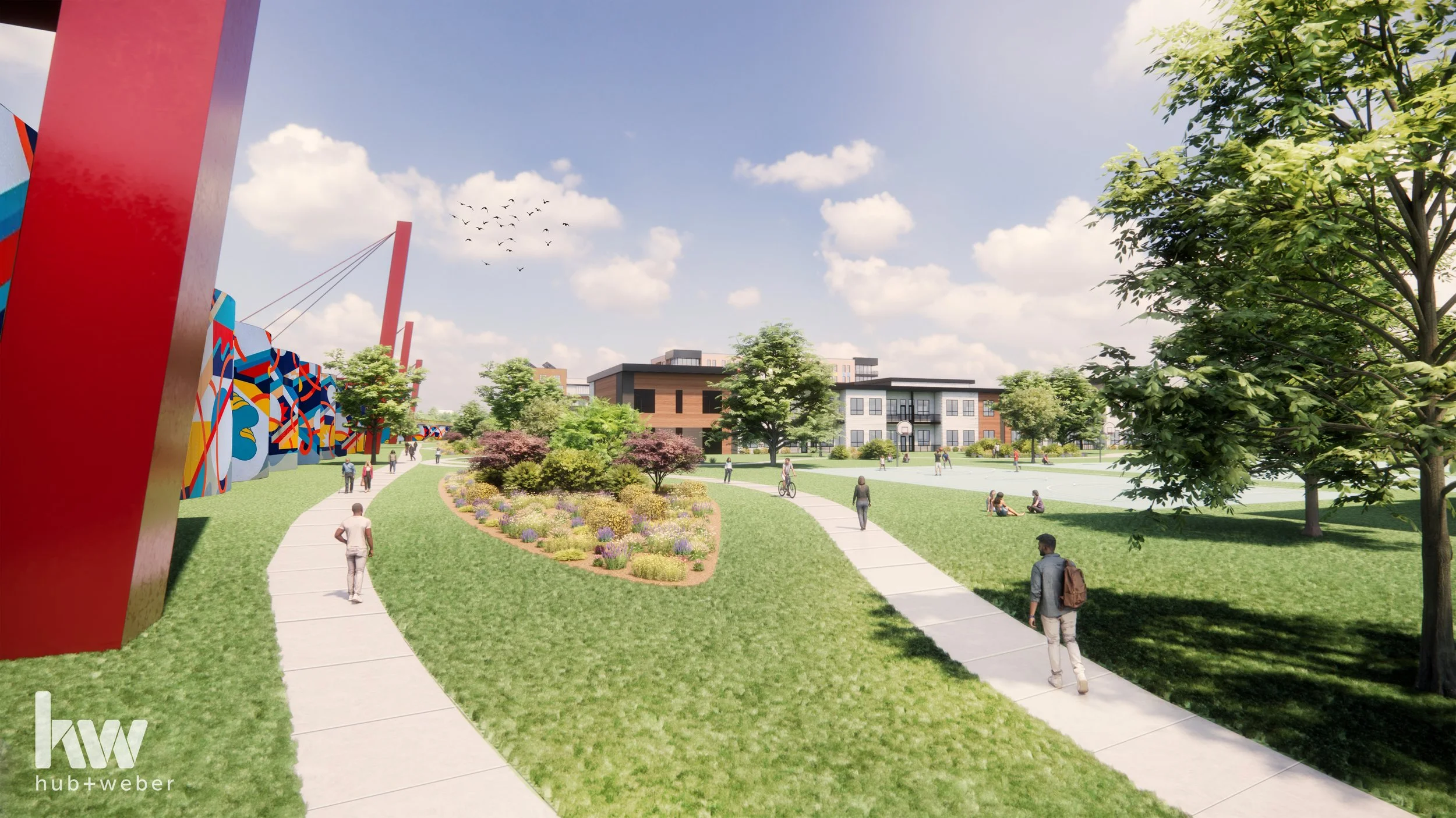
Some of the more traditional "park elements" would include large expanses of grass, trees and local plants, new athletic courts, and a new playground. Stepped landscaping would provide access to the pedestrian bridge as well as visual variety and interesting places to sit and read/picnic. Ultimately the new bridge and green space would become an anchor and gateway into the city of Newport.
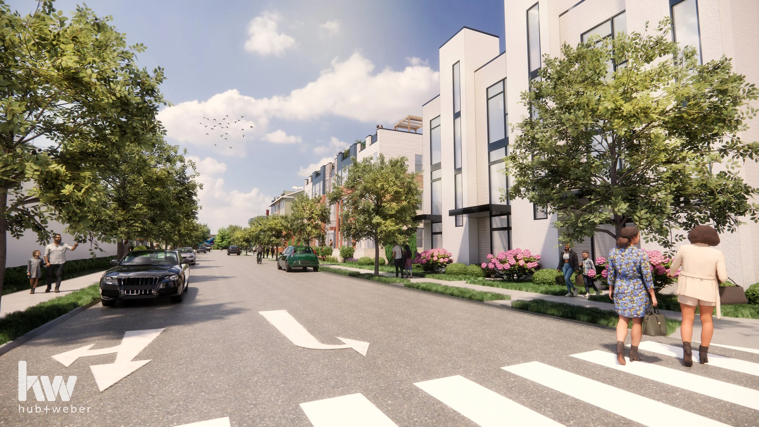
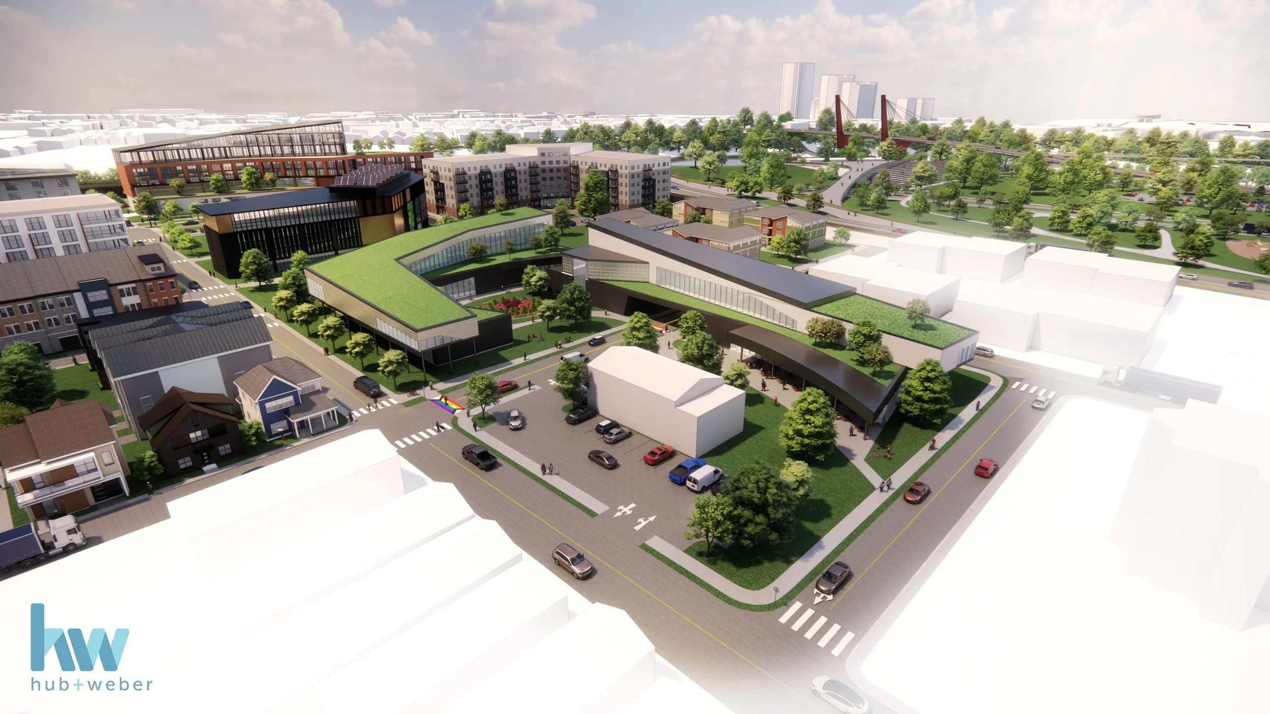
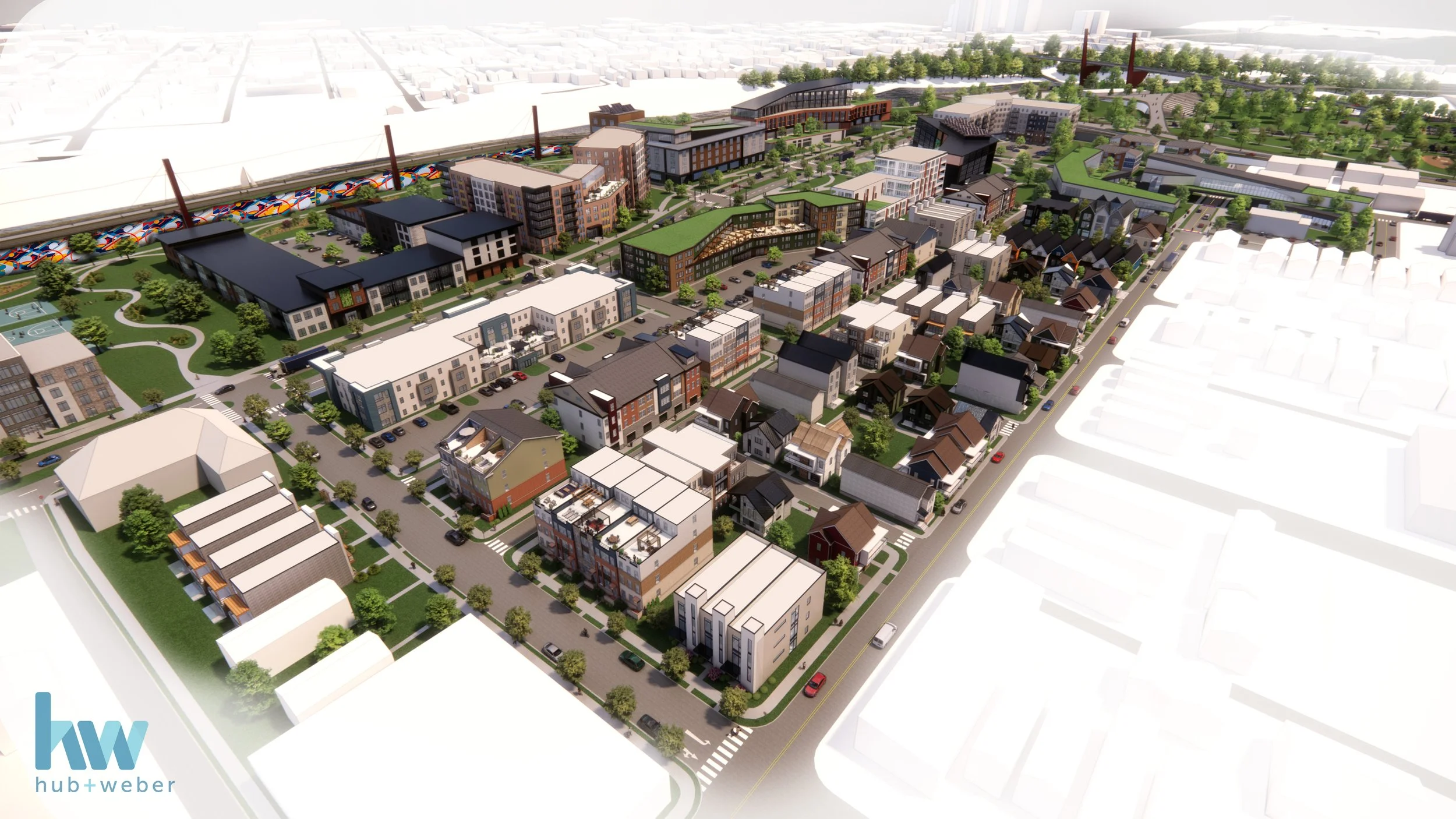
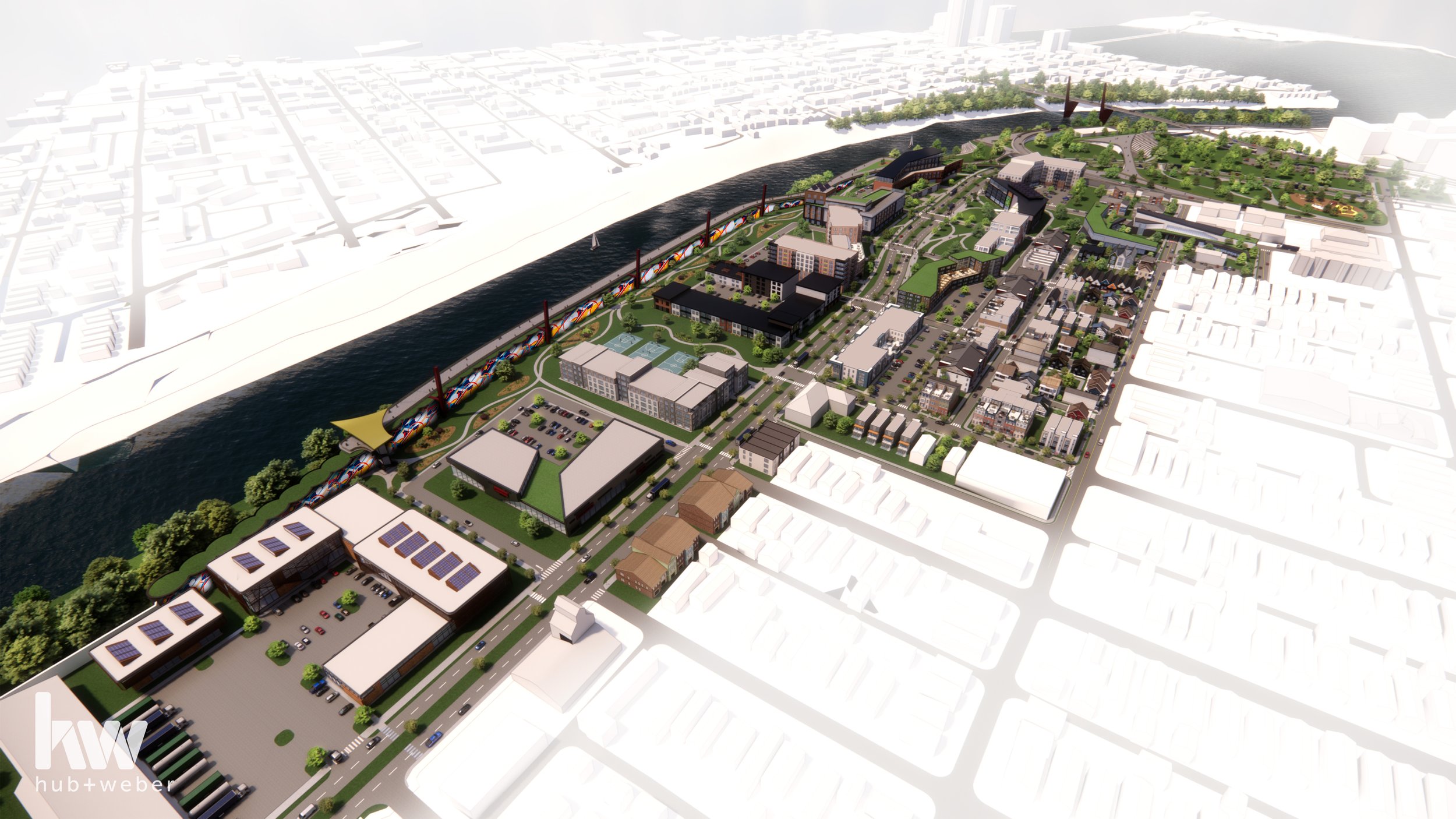
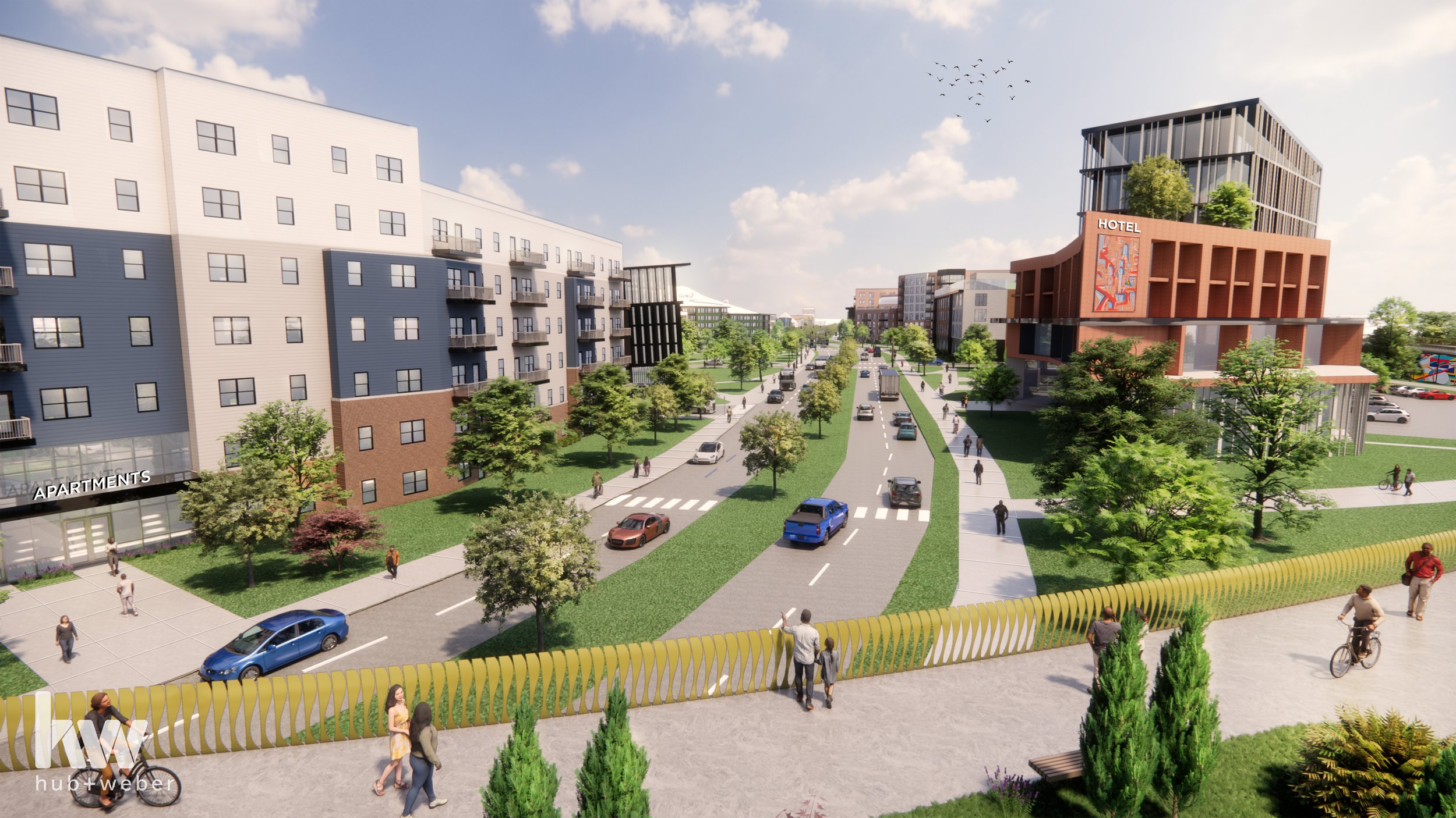
What’s a master plan without 3D rendering of all the hard work the community put into the project? Here is a handful of views to help you visualize what West Newport could look like:
What happens next? We’ll answer that in the final post coming up next so be sure to return to check it out.